ZoneVu Frac™ is the Completions Intelligence Engine
ZoneVu connects geology, drilling, and completions data into one shared, visual system – so completions teams can work from reality, not assumptions.
Understand the rock you’re completing – and make better decisions at every stage.
The Rock-Hard Reality
Not all rock behaves the same, even within the same well:
- Zones change
- Properties shift
- Faults appear
- Stress regimes vary
And when that variability isn’t understood:
- Stages fail
- Screen-outs happen
- Casing deforms
- Rock is skipped – or wasted
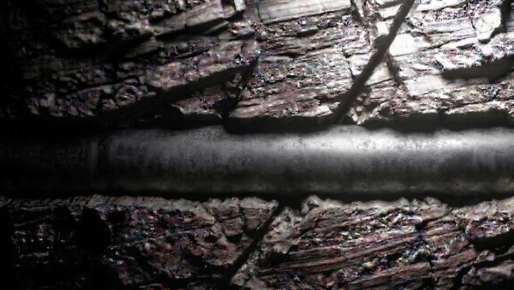
The biggest variable has always been the one we don’t control: the rock. And too often, it’s the least understood.
A Geologic System for Completions
ZoneVu changes where completions starts.
Instead of engineering around simplified assumptions, you start with the actual subsurface context.
- What rock are you in?
- How did it drill?
- Where are the hazards?
- What structures are present?
- How might the rock respond?
You’re not just adjusting parameters. You’re making informed decisions.
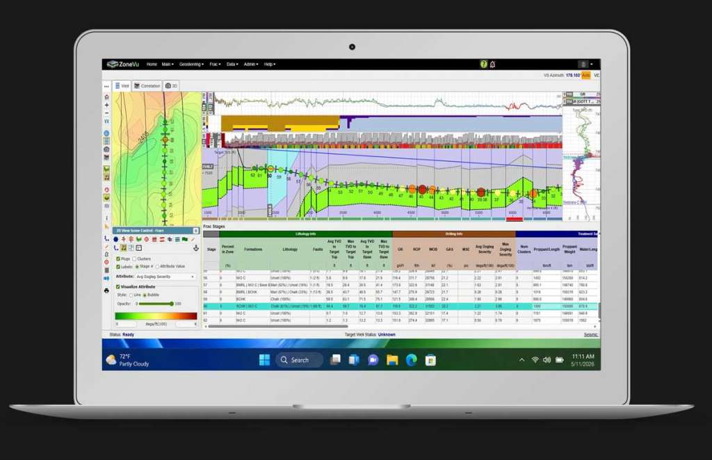
Foot-by-Foot Understanding of Every Stage
Every stage can be evaluated with full context:
- Rock type and variability
- Fault intersections and structural features
- Porosity and petrophysical properties
- Drilling indicators tied directly to depth and time
- Known hazards and risk zones
This is where completions moves from generalized design to stage-level understanding.
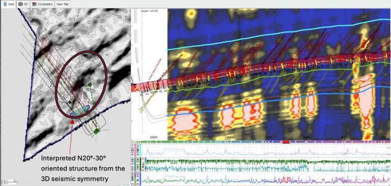
Working with the Rock – Not Against It
Completions is energy management. You’re interacting with a dynamic geologic system.
Sometimes faults create risks and sometimes they create opportunities; the difference is understanding where and how.
ZoneVu helps you see where to push – and where not to.
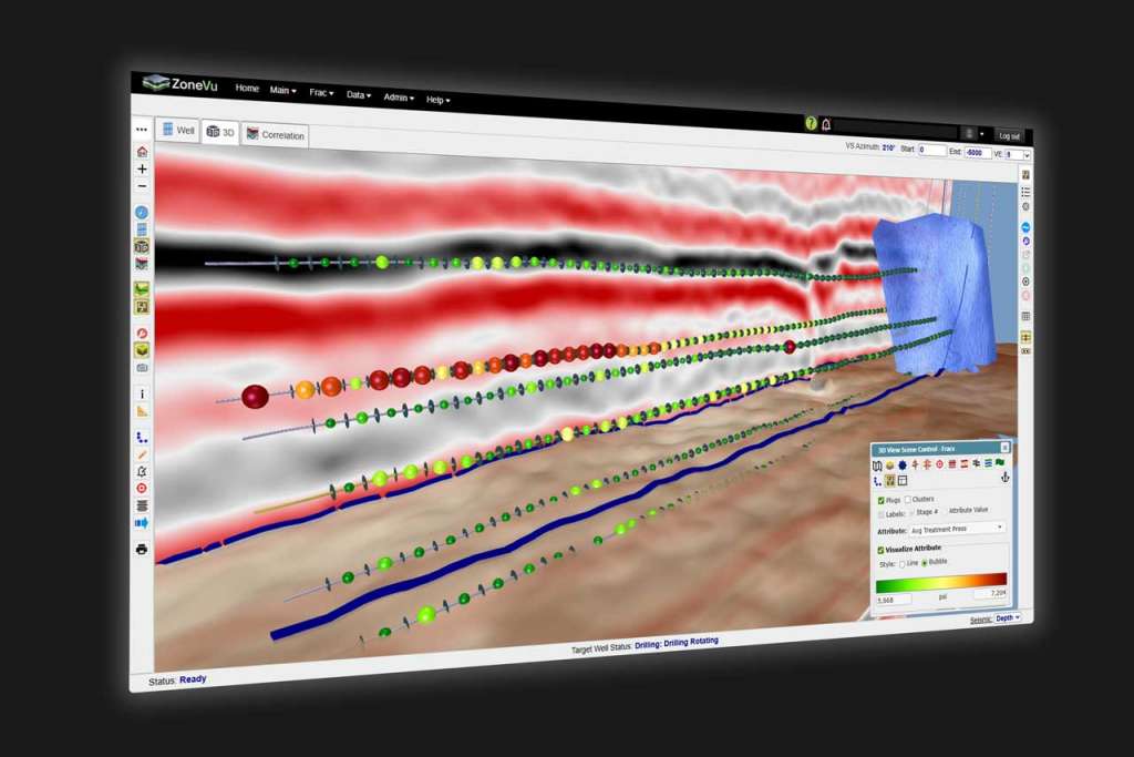
Real-Time Frac Visibility
ZoneVu Frac doesn’t stop at planning.
As you complete the well, you can:
- Monitor pressure behavior (ISIPs, trends, anomalies)
- Identify early warning signs of screen-outs
- Connect pressure response to rock characteristics
- Adjust in real time based on what you’re seeing
Engineers can layer completions designs with seismic attribute volumes, drilling, geosteering, image logs, and petrophysical data in map view, cross section – and in 3D.
"ZoneVu helped us be more predictive and avoid expensive problems."
Jon HoltDirector of Completions
"We now have feedback throughout our teams that has allowed us to make material changes to our completions designs, and has assisted in the reduction of stage failures because we understand the rock we’re treating better."
Greg DeRondeCompletions Engineer
"ZoneVu brings all data back to the geology in a way that no other software does."
Julie TannehillCompletions Engineer
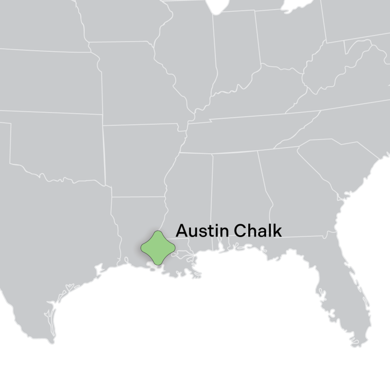
[CASE STUDY]
Real-World Impact: Austin Chalk Operator
See how ZoneVu helped an independent operator prevent wellbore loss and screen-outs in the Austin Chalk.
- Fault interactions were identified and understood
- Screen-outs were tied to rock properties and design choices
- Teams adjusted in real time
- Significant cost and operational impact was avoided
A Rock-Informed System for Completions
ZoneVu brings together:

Everything is aligned, visualized, and accessible in one place.
ZoneVu Frac Capabilities
- Identify faults and structural features
- Understand casing deformation risk
- Analyze frac interactions and offsets
- Align drilling decisions to completions outcomes
What Completions Teams Gain
- Improved stage design with real subsurface data
- Reduced execution risk at the well level
- Increased consistency across development programs
- Protected capital and maximized production performance