Three Rigs, One Geoscientist, and ZoneVu®
Use Case: Hibernia Resources
What Hibernia Resources Needed
ZoneVu was the Solution
With ZoneVu, data handling disappears into the background. RigStream™ pulls and conditions rig data automatically – replacing multiple systems, logins, and manual updates with a single, continuously updating view. Everyone sees the same data visualized – in depth, in context – on any device. Now, instead of managing data, the team focuses more on decisions.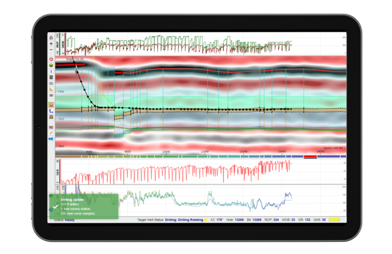
A Real Moment That Matters
With ZoneVu, Reed has easy remote access to all his projects – wherever he is working. That matters for the moments that don’t happen in an office. Thanksgiving. Family. No laptop. It happened.
Instead of being stuck, he opened ZoneVu on an iPad and kept the well on track – with full context, real-time data, and no disruption. And with ZoneVu Alerts™, he can set automated texts to flag when attention is needed – so he’s not constantly watching the well, but never disconnected from it.
“Being able to open ZoneVu anywhere and access any interpretation has been truly game changing.”
Reed Stevens, VP of Geoscience
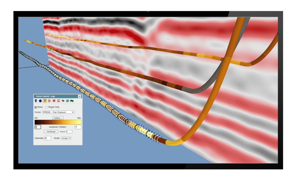
Connecting Geosteering to Completions
Before ZoneVu, completions teams often worked without full geologic context. Perf plans weren’t tied directly to the interpretation, and problem intervals were often discovered after something went wrong.
With ZoneVu Frac™, perf plans are layered directly on the geosteering interpretation, seismic, and drilling data – before the job begins. That means:
- Lithology is visible ahead of time
- Problem stages are identified before pumping
- When issues arise, the full dataset is already there – no reconstruction required
One System, Not Many
At its core, ZoneVu is a centralized, persistent database for all real-time and historic data.
Data are loaded once or pulled from the rig automatically – and are available everywhere.
As you drill, you get auto-conditioned gamma ahead of the last survey, ready for interpretation.
Everything is aligned and actionable.
Operational Impact
When data workflows are automated, lean companies like Hibernia can operate at full capacity with their existing team structure.
Operations get tighter – with less friction between drilling, geosteering, and completions.
Geosteering decisions get faster, with better visibility.
Completions strategies get context already built – not manually assembled by busy geologists.
Everyone works from the same integrated picture.
Key Learnings
- A single geoscientist with 3 rigs reduced his manual workflows
- Automated, real-time rig data kept their teams in sync
- Geology and completions in one system delivered easier, better context
- Problem stages identified pre-frac helped them prepare
- Company-wide visibility created a tighter, more agile team unit