Geosteering with Real-Time Clarity
Geosteering is where cash flow is won or lost.
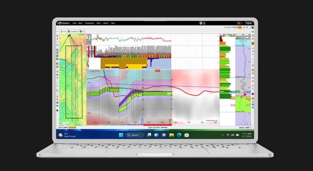
ZoneVu® gives geosteering teams a unified view of live and historical data – so you can interpret, adjust, and collaborate without trading license seats.
See your data integrated in one place. Stay in zone. Make confident calls in real time.
The Reality in the Wellbore
When you’re drilling, you’re interpreting the subsurface one foot at a time – with incomplete, evolving data.
Signals aren’t always clear. Data is often over-conditioned.
What looks right in one moment can shift in the next.
ZoneVu changes that.
Real-time data streaming
No more steering off emailed files or delayed updates
One source of truth
Logs, surveys, grids, seismic, and drilling data in one live view
Team alignment
Geology and drilling working from the same live context
Secure access anywhere
Cloud-based, secure access from any device
Frac-ready insights
Completions context is built as you drill
Real-Time Capabilities for Drilling and Geosteering Teams
Built for real operations, not dashboards.
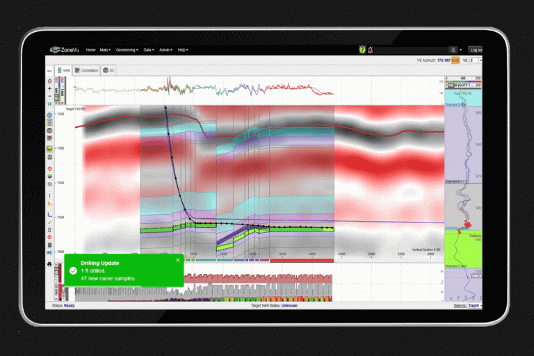
Get clean, interpretable LWD data – ahead of the last survey, every 2 minutes.
RigStream™ is ZoneVu’s cloud agent that connects directly to your rig data through WITSML.
- Automatically pulls and conditions data
- Preserves access to raw signals
- Lets you control how data is interpreted
Your rig data becomes immediately visible and actionable - for everyone involved in the well.
Get Closer to the Raw Data
With ZoneVu, you’re not locked into someone else’s version of the data.
ZoneVu gives you control over LWD conditioning.
- Strip away smoothing when it hides signal
- Adjust conditioning parameters in real time
- Work closer to the underlying measurements of the rock
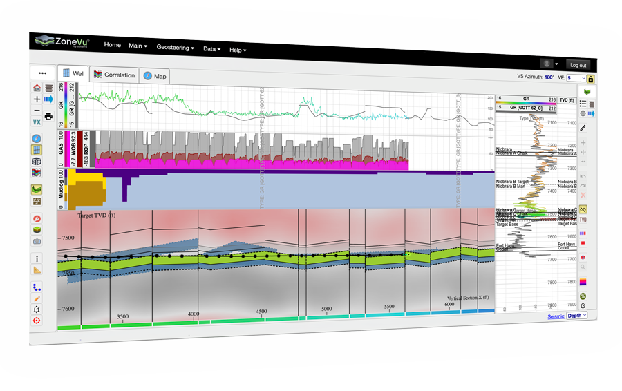
Tailored Views for Real-Time Decisions
Switch seamlessly between:
- Correlation panels
- 3D visualization
- Map view
- Cross-section
All synchronized. All live.
- See the bit location in real time
- View conditioned data ahead of the last survey
- Align interpretation with full spatial context
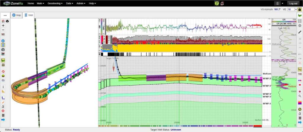
U-Turn Drilling – When 3D Matters
Complex wells, like U-turn trajectories, lack spatial context in 2D.
ZoneVu shows the wellbore in 3D and measured depth, so teams can:
- Stay in zone through complex turns
- See hazards before they become problems
- Understand the well’s position in real space – not a projection
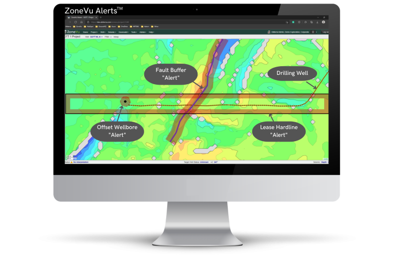
ZoneVu Alerts™ Helps You Avoid Costly Drilling Mistakes.
ZoneVu monitors your well in real time, alerting you to potential hazards as they develop.
Get instant text and email alerts for lease lines, offset wells, faults, dogleg severity, wellbore proximity, rock and inclination changes, and more.
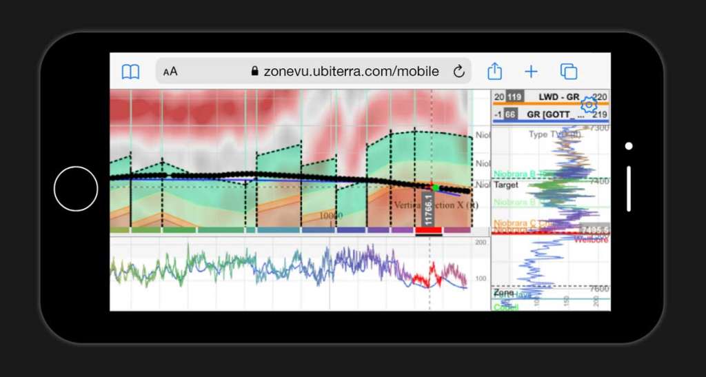
Mobile Access – Designed for the Way You Work
Operations don’t happen at a desk.
- Access ZoneVu from any device or browser
- Secure login via Microsoft 365 integration
- Full visibility from the rig, office, or remotely
Forgot your laptop? You still have access.
A Real-Time WITSML Store Without On-Site Hardware
ZoneVu is a cloud-based WITSML store – automatically organizing incoming data into a continuous, depth-and time-indexed record.
- Depth-aligned logs and surveys
- Time-based drilling data
- Rig notes tied directly to MD and time
- Complete foot-by-foot drilling history
No hardware. No manual transfers. No delays.
What ZoneVu Gives You

Real-time visibility while drilling
Decisions made with full subsurface context – not fragmented data

More control over your data
Adjust and condition independently of MWD hands

Faster, more confident decisions
Your whole team sees the same picture in real time

A complete, trusted record of every well
From first survey to TD